Diploma in Surveying using Total Station
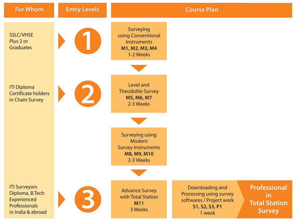
This is one of the most popular courses offered at V Institute, which trains the student to become a high quality professional surveyor equipped to handle state-of-the-art instruments and software applications. The course is so structured as to enable the students to enter the course at different levels depending on the basic educational qualifications attained by them.


DESCRIPTION
COURSE CONTENT
Applications covered in the Course
- Surveying
- Free Station Surveys
- Tie distance
- Road Design & Stake out
- Area (Plan)
- Remote Height
- Computation (COGO)
- Reference Line
- Longitudinal & Traverse Profiles
- Contour Map
- Cross Section
- Cut and fill volumes
- LisCAD
- AutoPlotter
- Road Estimator
Major practical sessions
- Column alignments and column set-out
- Stake-out pile points with reference to existing structure
- Establishing new benchmarks and cross checking
- Lay out pipelines and marking inverted levels
- Lay out points for storage tanks
- Lay out transmission lines and bolt fixing
- Set out octagons, hexagons, circles, etc
- Preparing Survey Reports to International Standards