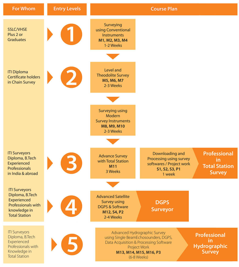
Diploma in Hydrographic Survey
The course provides the students practical knowledge and hands-on training in the application of techniques of hydrographic surveying and develops the essential skills required to carry out the various operational tasks in hydrography.


DESCRIPTION
COURSE CONTENT
Applications covered in the Course, in addition to the subjects in Levels 1 to 4
- History and importance of hydrographic surveying
- Tides and water currents
- Coast lining
- Positioning (horizontal and vertical controls)
- Laws of sea
- Sonar theory and acoustic sensor fundamentals
- Echo sounder and sounding methods
- Sea-floor classification and feature detection
- Topographic surveying
- Dredging
- Survey planning
- Survey data processing and final chart preparation
- DTM and DEM
- Electronic navigational charts and raster navigational charts
- Volume calculation from hydrographic survey charts
- Volume calculation for dredging
- Topographic information
- Bathymetric information
- Project work
Major practical sessions
- Receiver set up
- Configuration of the receiver
- Configuration of the terminal
- Satellite tracking
- Different parameters setting and Data storing
- Localisation of WGS 84 Coordinates
- Establishing stations and TBMs with reference to
- Survey of India BM (Control Points)
- Altitude
- Stake out of the measured points and offsets
- Self survey mode (absolute positioning)
- Static Surveys and rapid static surveys
- Kinematic and RTK surveys
- Post processing of surveyed data and exporting the data to AutoCAD
- Topographic surveys using RTK mode and establishing control points using static mode
- Precautions to be taken while using GPS receivers